I could see stars on the drive up to Appalachia, which is a good sign, especially considering that the plan for the day was to hike above treeline. I was headed northward to meet my friends, Schorman and LadyDi for a hike of the three northern Presidentials, Jefferson, Adams and Madison. The day seemed to be ideal, with very low winds, mild temps and very little snow. This is a bit unusual for December, but the hikers have been taking advantage of the conditions.
The first order of business for the day was to set up the carspot, since we were doing a one-way hike. I loaded my gear into their car and we set off for Jefferson Notch Rd. The Schors had already scouted it out and it was still open, although many other seasonal roads had just been closed for the season. Up we went from Route 2, and since it was unmaintained, there was plenty of snow and ice to make for a careful ride up to the Caps Ridge trailhead.
We arrived, got ready and started up the trail for the summit of Jefferson. The trail had a nice coating of snow, which was already filling in the rocks making the first mile or so up the pothole rock and lookout pretty easy. At this point, we could see a very dark cloud layer coming in from the west, even though the forecast was for clouds and part sun. After that, we headed up the trail to the caps, three large bulges of rock to clamber up and over, the namesake of the trail. We really only needed light traction for the caps since there was some ice on the rocks, and not a consistent coating.
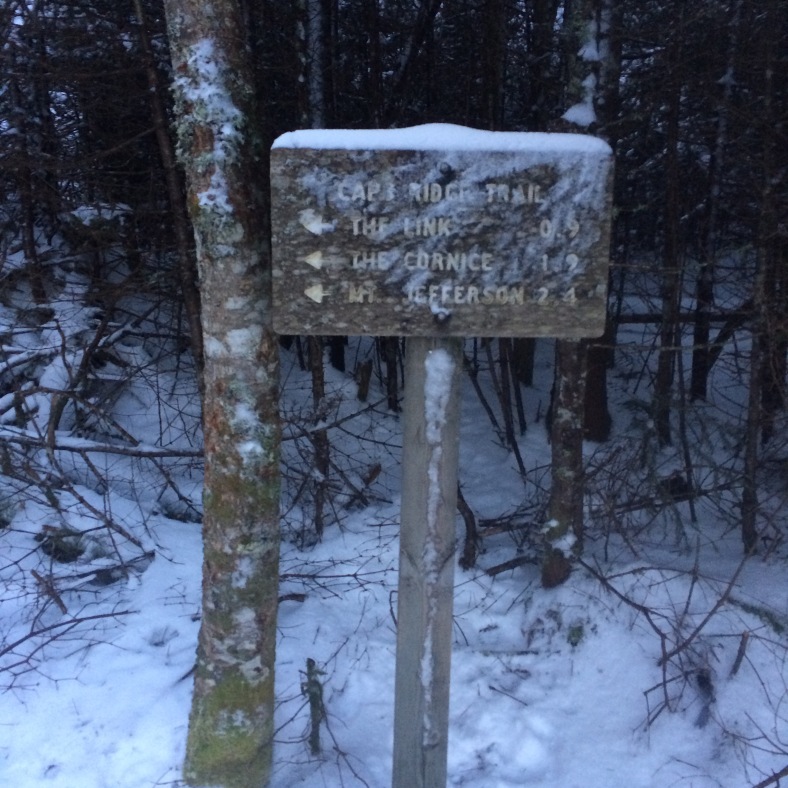
Caps Ridge trailhead sign. This trail won’t see much use in the coming months when Jefferson Notch Rd. closes for the season.
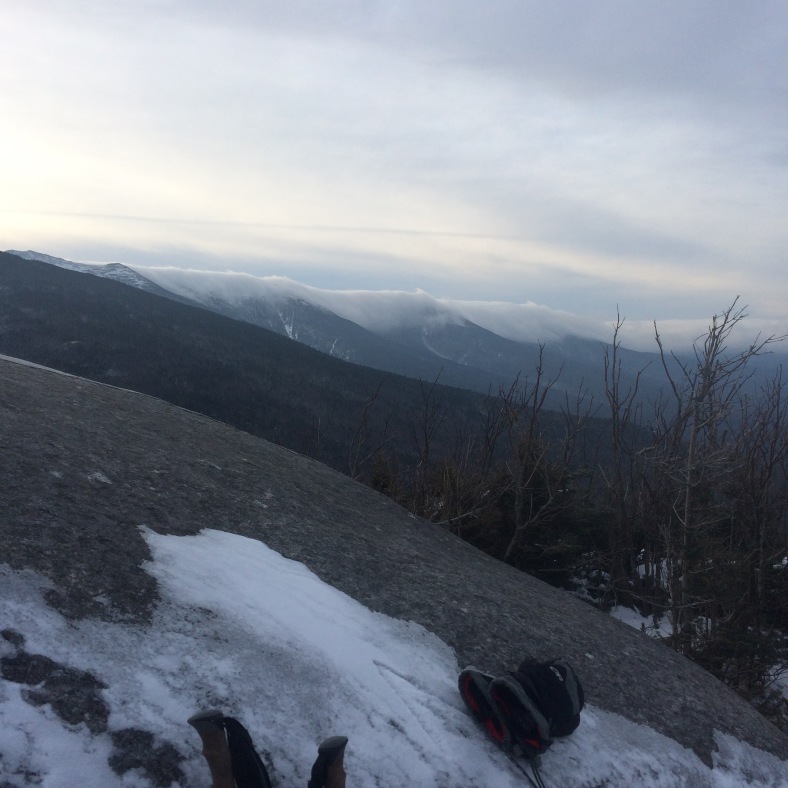
A cap of white clouds over the southern Presidentials.
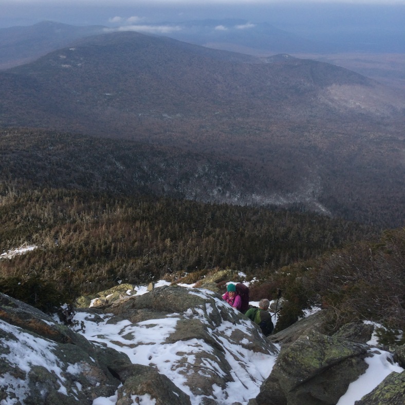
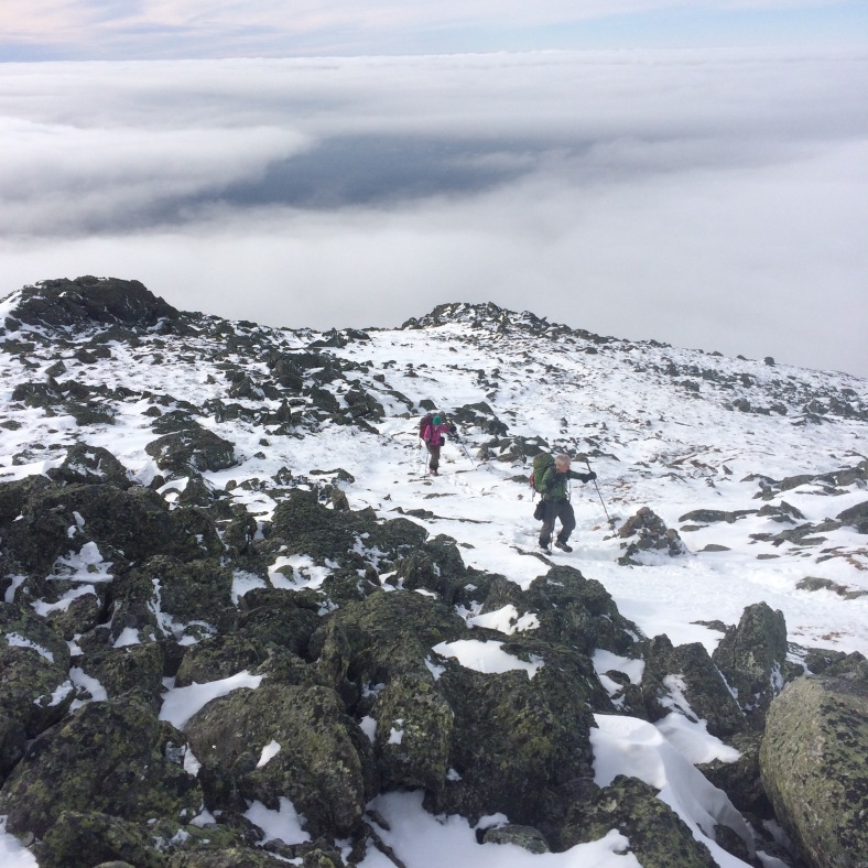
Schorman and LadyDi taking a break to add some traction below an icy scramble.
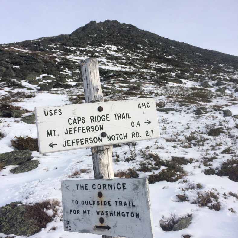
The first part of the summit cone of Jefferson. The false summit seen here; the true summit is beyond and above it.
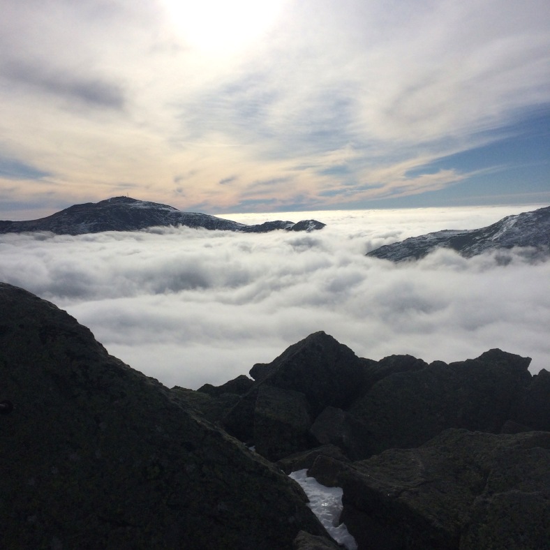
The next part of the trail was a question for traction, since we were now going up the rocky summit cone of Jefferson, which as all the northern Presidentials are in reality, just a huge jumbled pile of rocks. Traction wasn’t necessary, but useful in places and soon we were on the summit. By this time, the clouds had moved eastward and engulfed the White Mountains. Anything above 5000 feet was above the clouds, which gave us spectacular views of the undercast. Only the mountains immediately around us were visible and far off in the distance we could just see the top of Lafayette. Other than that, we were above an ocean of clouds.
Schorman and LadyDi above the false summit and making their way toward the summit of Jefferson.

Mt. Washington from the summit of Jefferson. The clouds have now surrounded the entire range.

Looking ahead to Mt. Adams from Mt. Jefferson.
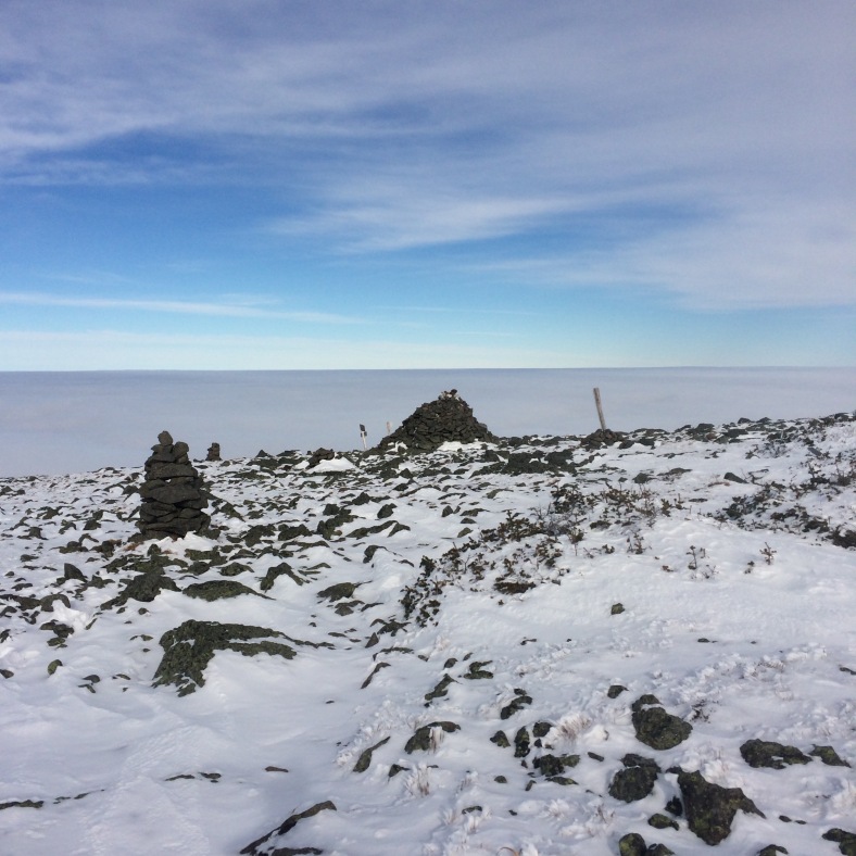
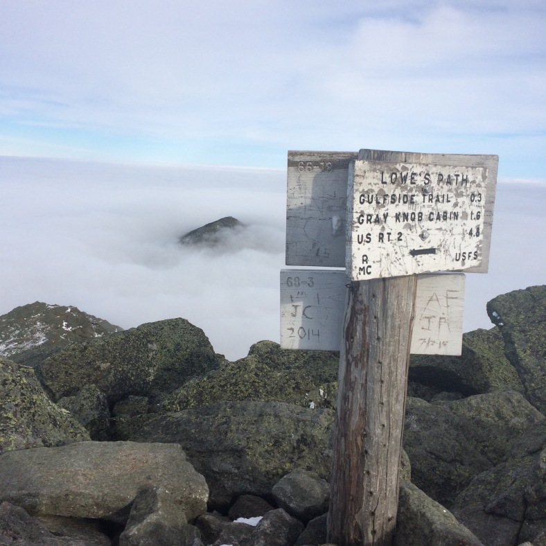
From the summit of Jefferson, we made our way to Thunderstorm Junction, a few miles away. We traversed the Jefferson snowfield, which now has a nice track over it and then down into a bit of cloud in Edmands col between Jefferson and Adams. We were climbing up toward Thunderstorm junction near Adams when all of the sudden we were in the clear and back out of the clouds. It was as if someone had flipped a switch and we were treated to more incredible views. We arrived at Thunderstorm Junction, still above the clouds and it looked as if the land just dropped away into the clouds. The weather so mild, that we sat around the base of the gigantic cairn and ate lunch.
Approaching Thunderstorm Junction. The land just seems to drop off into the sea of clouds.
With lunch over, it was time to head up Adams. LadyDi decided to head around Adams and meet Schorman and me at the hut after our trip over the summit. It is a quick few tenths to the summit from Thunderstorm Junction and we chatted with another hiker there and then descended back into the clouds. The summit of Madison had been in and out of the clouds all day, and we did not anticipate many views from there, but were so blessed with such a great day above treeline that it didn’t matter.
Another view of Mt. Washington from the summit of Mt. Adams.
Looking ahead to Mt. Madison, barely out of the clouds from the summit of Mt. Adams.
We met LadyDi for break at Madison Hut and she headed down Valley Way, while Schorman and I did the quick round trip to the summit of Madison. We were in for one more treat. We hiked one more time above the cloud level and had some great late afternoon views of the peaks above the clouds. After that it was farewell to the heights and down Valley Way for the long trip out to the car.
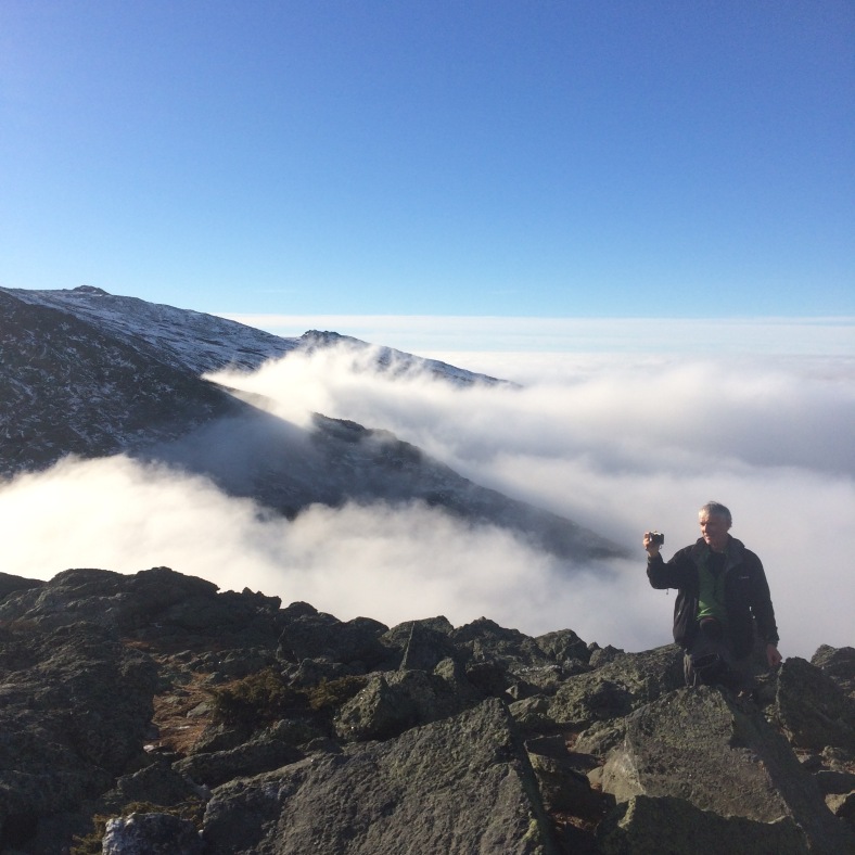
Schorman with his camera near the summit of Mt. Madison.
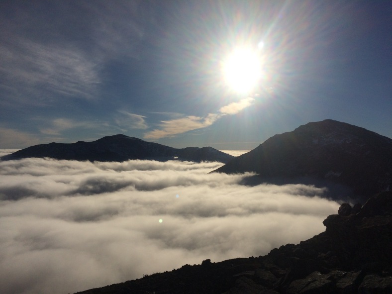
One last view for the day, Washington and Adams.
Every trip above treeline is pretty special, but there are some that are just more spectacular than others. This was one of those days. I am sure that from the valleys below, the high peaks were not even visible and certainly not inviting swathed in grey clouds, but for those of us above the cloud, it was a spectacular day indeed.
Special thanks to Schorman and LadyDi for such wonderful company above the clouds.

Amazing trip!
What a special day you had above the clouds!
Thanks – it was a blessing to have such a great day!
hey,
nice trip.
I am just wondering how long he takes to you to do the 3 peaks and how many miles (I think around 9,7 miles?)
Thanks for stopping by, Alice! Sorry I did not reply sooner. Yes, it is about 9.6 miles or so, give or take a few tenths. As far as how long it took us, probably about 8 hours or so. We did not hike as fast as we were capable of and we took our time to enjoy the views and take a lot of pictures.