Back on the trail again, this time the Monadnock Sunapee Greenway Trail. The MSGT is 48 miles long and goes from the summit of Mt. Monadnock to the summit of Mt. Sunapee through the western part of New Hampshire. Add to that a couple of miles on either end for approach trails, and it is a good 3 to 4 day backpack adventure. I figured, it is here in my own state, easy to get to, so why not hike it?
The only real logistics for this trip were dropping off a car at Sunapee and getting a ride to Monadnock. Lucky for me, I have a great family who will help me out. My daughter helped me drop off my car at Sunapee and my husband just happened to have a meeting with a client in Merrimack. He was able to drop me off before the meeting, which was perfect.
Day 1 Thursday July 21, 2016 Monadnock State Park to Crider Shelter. 19.8 miles
Having hiked Monadnock a few times before, I knew that would be the hardest part of my day. Sure enough, the good old White Dot Trail did not disappoint. Yes, I could have chosen another approach, but I wanted the most direct and shortest route. In New England, the shortest route is usually also the steepest route. No exception for this trail, but it got the job done and soon I was enjoying views and breezes on the summit.
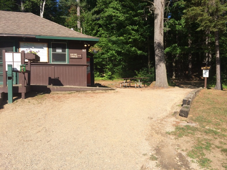
Hiking trails begin behind this little camp store at the parking lot in Monadnock State Park.
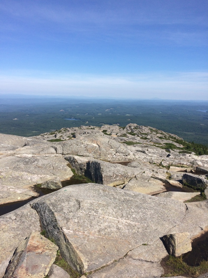
Looking northward from the summit of Mt. Monadnock to where I’ll be traveling in the next few days.
Now the real fun began: descending Monadnock and actually starting the MSGT. The Dublin Trail is the correct trail to descend, and it was similar to the ascent, rocky and slabby until the trail was quite a ways below tree line and into the forest.
After that, the trail was much easier, with small hills mixed in for variety. There was a variety of actual trail. Some of it was regular forest trail, some was on old woods roads, some was dirt roads with just a little blacktop walking, and then there was some grassy trail. Oh, plus a few power line cuts just for fun. The variety was good, and the blazing was pretty good, too. So far, there were not any vague places and the trail is followable.
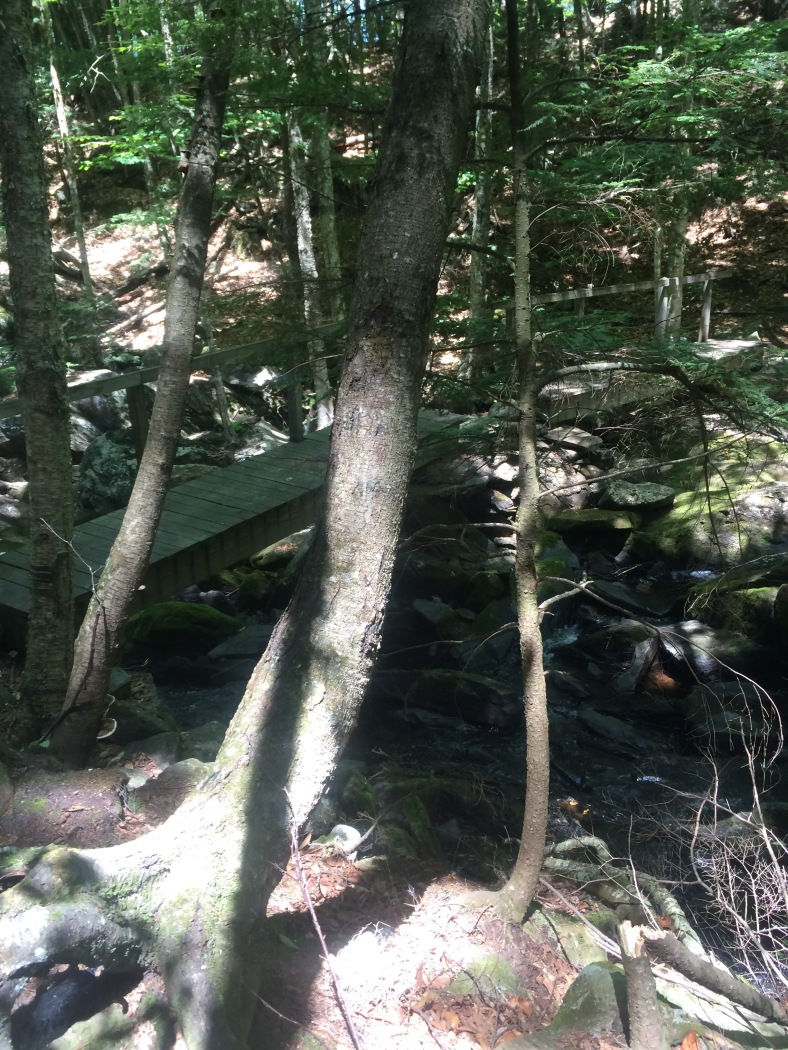
Double bridge over Eliza Gorge. The water was not high today, so the crossing was easy and pleasant.
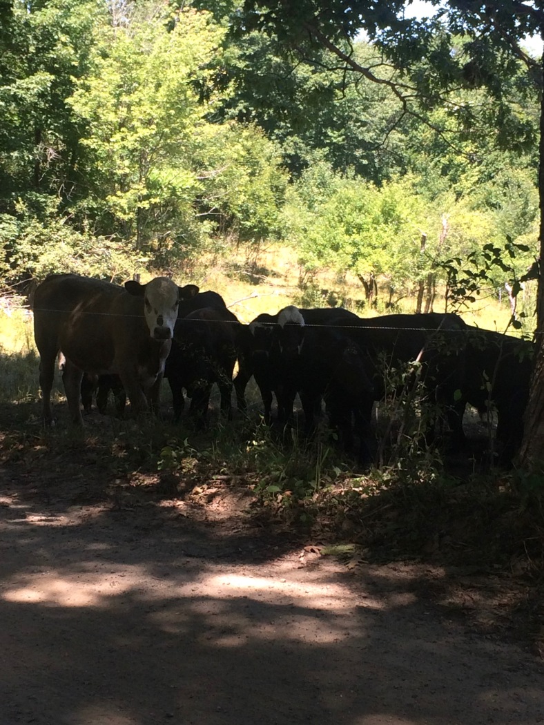
Cows! The MSGT travels along some country dirt roads, where I saw these cows hanging out in the shade.
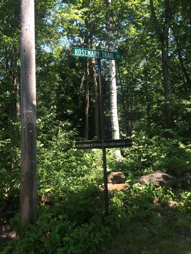
Trail, road, or both? No matter, this turn was well blazed and signed.
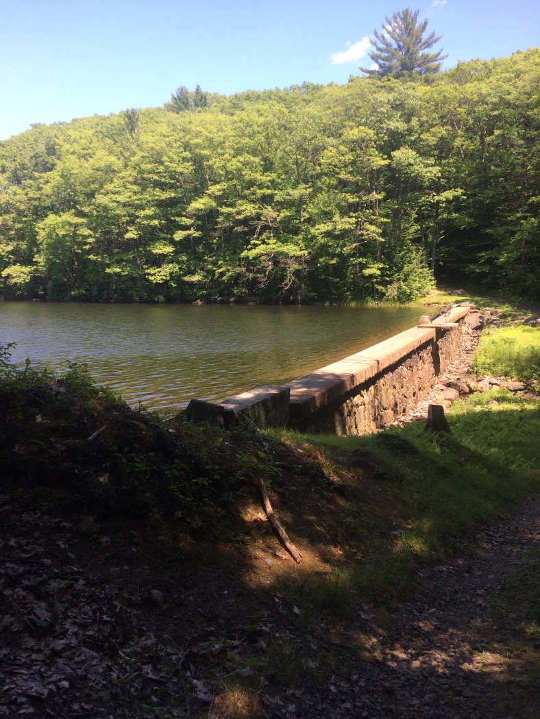
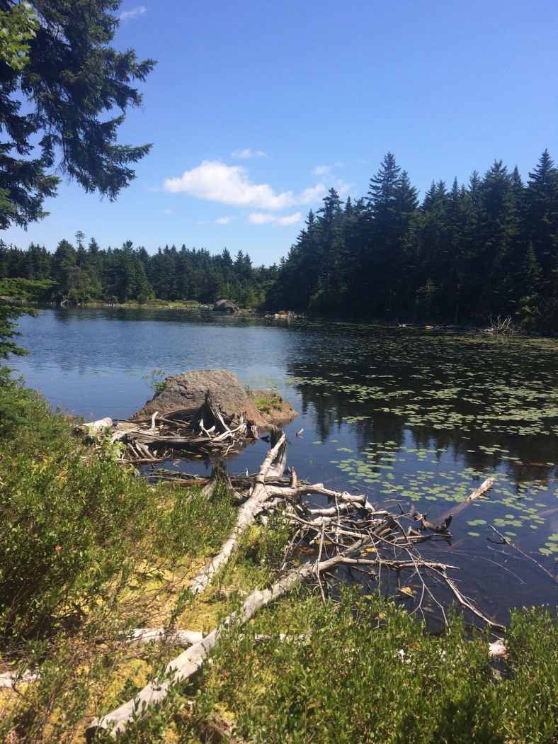
The MSGT goes right past several dams, lakes and streams. This is the Child’s Bog Dam.
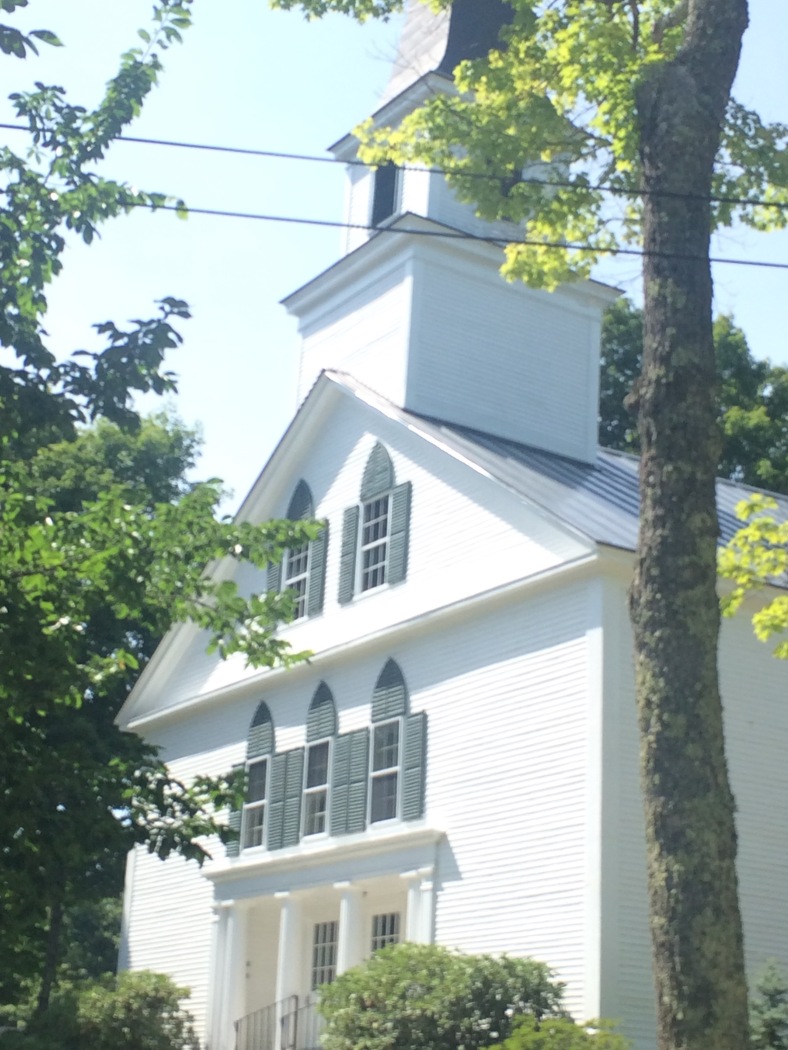
Church in Nelson Center. The trail goes right through the little village of Nelson Center and right by the church.
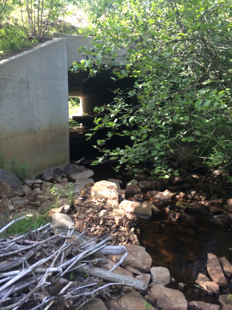
Culvert! Yes, the MSGT also includes a trip through a culvert just for fun. Actually, it is much safer to walk through the culvert than to try to cross Rt. 9 when it is busy.
As far as other hikers, the last ones I saw were on Mt. Monadnock over 17 miles ago. So far, I have seen no one else. I am staying at Crider Shelter tonight and no one else has shown up. There is always the chance that someone will show up later. We will see.
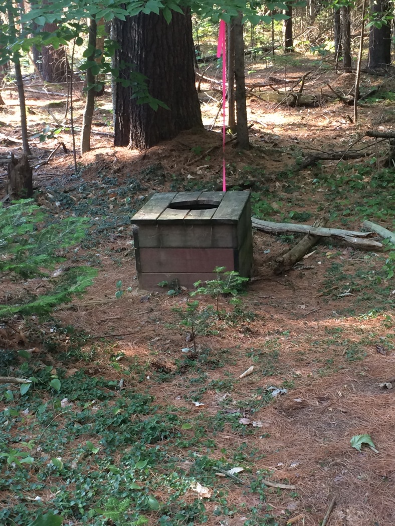
Privy at Crider Shelter. I haven’t seen one this, um, simple since somewhere in southern Virginia on the AT last year.
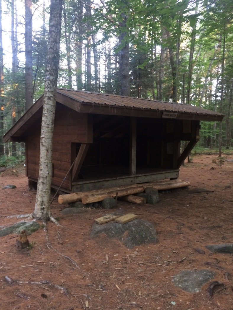
Crider Shelter. Can sleep 6-8, plus a few more if it was raining. It was nice and clean, as was the area surrounding the shelter.
The plan for tomorrow is to hike to General Washington Shelter. That is only 13.4 miles away. If I get there too early, I will push on to the next shelter, Max Israel. No sense in sitting around a shelter for almost 6 hours waiting for the sun to go down. Another plus is that it will make the last day shorter, and with afternoon thunderstorms predicted that might not be a bad thing. Depends on how the day goes.
Day 2 Friday July 22, 2016 Crider Shelter to Max Israel Shelter 18.8 miles
I got an early start thanks to some logging equipment nearby that started up around 6:00a. I had planned to be on the trail by 7:00a anyway, so the extra half hour of cooler temperatures was actually a bonus.
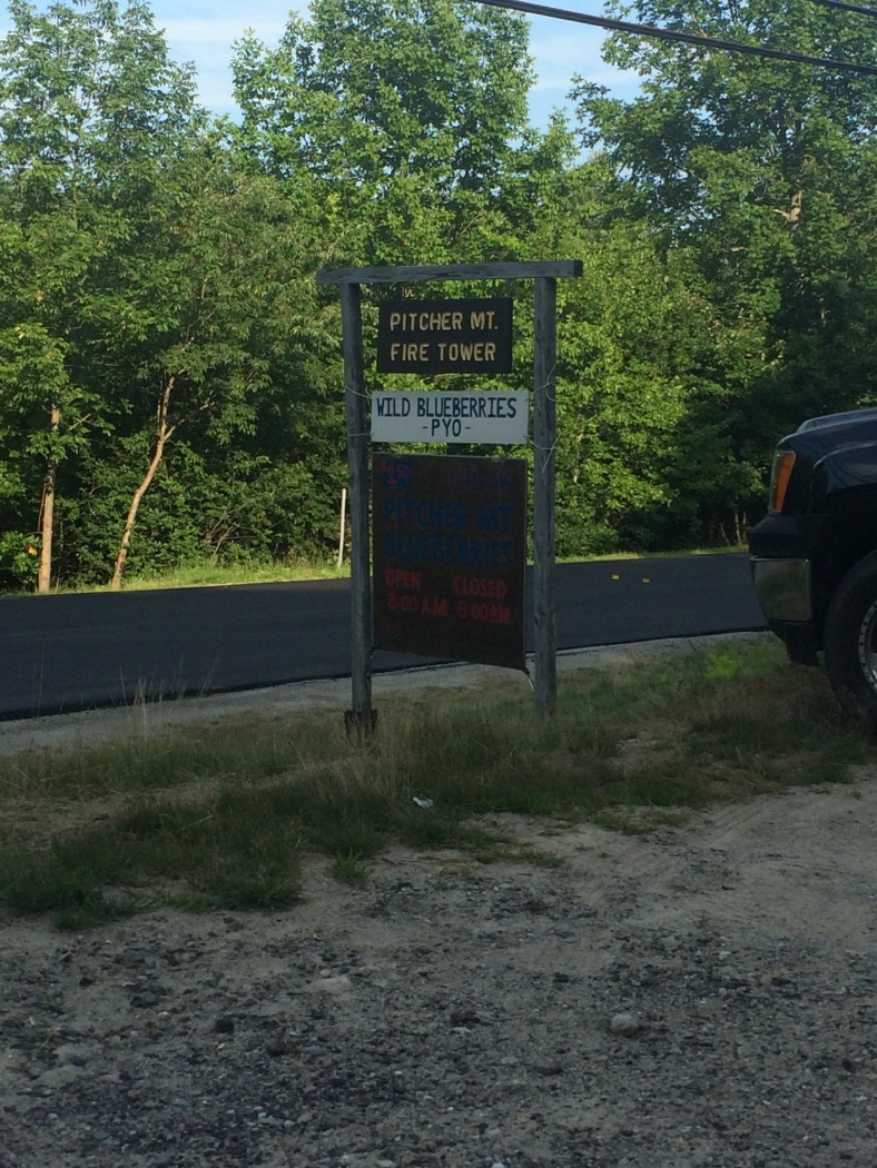
The morning was cool, although still humid. I made good time and headed into the Andorra Forest. What a lovely forest and the trails were well maintained. I skirted some blueberry patches and crossed Rt. 123, and started the ascent up Pitcher Mtn. where I met a local couple and their dog going up to the fire tower area to pick blueberries. After a quick chat, I was on my way, but not before I sampled some of the wild blueberries. Pitcher Mtn is privately owned, but blueberry picking is allowed, with an honor system to pay per pint. In the next hour or so, I hiked through another blueberry patch, too. I then came to the possible detour due to beaver pond flooding. I took my chance, it was only 100 feet of flooded area, I wouldn’t mind walking through it if I had to. I never saw that section. My guess is that due to the logging in the area, the road has been improved enough for the big trucks and that problem is gone.
The day was getting more hot and humid and by the time I got to the General Washington shelter at 12:30p, I really needed a break. I decided that I wasn’t going to stay because it was too early, so after a short break I headed into town for a couple of cold drinks and some lunch. The Washington General Store had plenty of that and more, but as a side note, they only take cash. Feeling better hydrated and rested, I hiked out of town for the last 5.5 miles to the Max Israel Shelter. It was hot and humid, so I took my time, not pushing too hard on the hills and still made it to the shelter with plenty of time to relax.

Small cascades in a stream by the trail in the Andorra Forest.

Really nice trail in the Andorra Forest.
Great place to pick blueberries, courtesy of the nice folks who own the land.
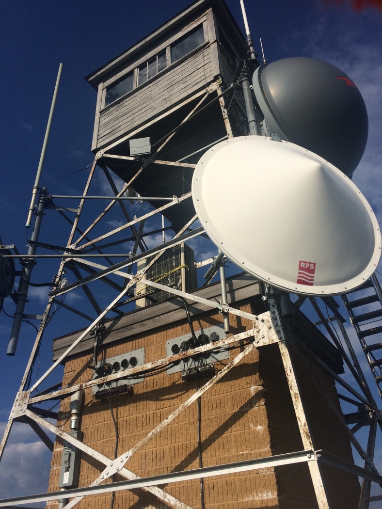
Firetower #2 on Pitcher Mtn. The original burned in the fire that swept across the hills about 75 years ago.
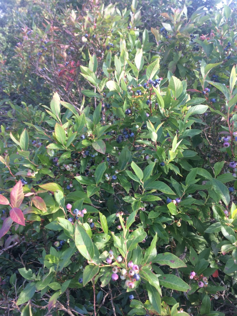
Blueberries! There were a lot of them, ripe and ready to pick. That’s one perk of hiking long distance trails in July!
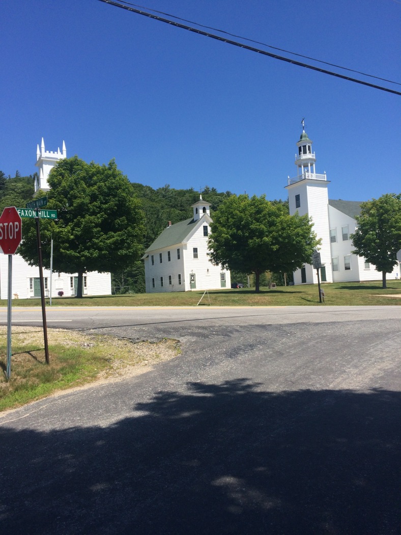
Three churches in Washington Center. To the left in less than 5 minute’s walk is the Washington General Store with all sorts of delights for a thru-hiker.
I did see three other hikers on the MSGT today, about 3 miles before Washington Center. Other than that, I only saw people on Pitcher Mtn. and Hubbard Hill blueberry picking. Tonight it seems that I have the shelter to myself again. That could still change.
Tomorrow is the last day of the trail. By doing the extra mileage today, I will only have 12 miles to hike tomorrow, and just 10 miles to Sunapee. Almost done!
Day 3 Saturday July 23, 2016 Max Israel Shelter to Sunapee to Sunapee Parking 12.1 miles
I did not have company at the shelter last night, so with no one to bother, it was another early start, on trail at 6:30a. The plan was to get more miles done while it was nice and cool before it became to hot and humid and before any thunderstorms built up. By looking at the elevation profile, this was also a good idea due to the roller coaster of little hills to go up and down before Sunapee. Less miles also meant that I would be home earlier rather than later. Off I went up and down the hills. I passed the Pilsbury State Park border and found a few things. One I had been looking for since the beginning of the trip, and the other, unexpected. I found a new bridge designed by and installed in part by Craig Sanborn, trail master. I have worked with Craig Sanborn in the past on trails and his work is impeccable and built to last. This bridge was no exception. I also found a most unusual piece of trail trash. It was a child’s fairy play wand. I am sure some child was sad to lose that. I did end up packing it out – so if it yours, let me know and I’ll send it back!
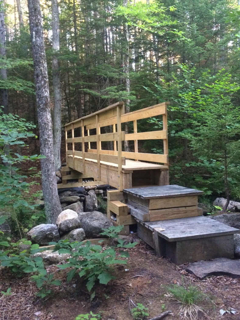
Very nice bridge installed by Craig Sanborn and the MSGT Crew.

Definitely a different piece of trail trash, or would that be treasure?
A few more hills later and very close to the Steve Galpin/Moose Lookout Shelter I saw another hiker. This was the fourth hiker in two days! She was part of a larger group of five that was also on their last day on the trail. They had stayed at the shelter the night before and were just getting started for the day. I chatted with them while they collected water and then was on my way up to Lucia’s Lookout. The day was hazy, so while the views were good, it was hard to see and far away details.
Eventually, I came to Lake Solitude, where I started to see more day hikers. It wasn’t a surprise because I was about a mile from the summit of Sunapee, the end of the trail. Up to White Cliffs, and then onto a ski trail for the last steep little bit. The top was in sight and then I was there, the end of the trail, the summit of Sunapee. Excellent views abounded, but I still had my eye on the clouds, it seemed like they were building and it was definitely time to move downhill. (A few hours after getting home with thunderstorms approaching, I looked at the radar and there was a very strong thunderstorm over Sunapee. Thank God for good timing!) All that was left was the two miles downhill to the car. I was pretty happy but those two miles seemed long!
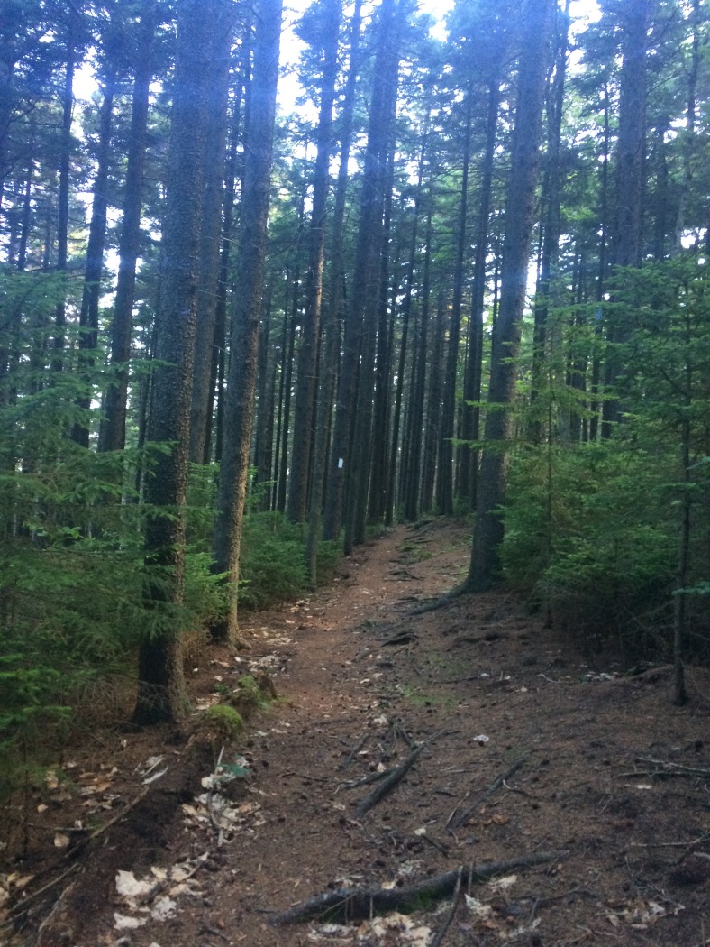
Lovely stretch of trail through a stand of pines.
Lake Solitude. The trail travels part way around the edge of the lake, just about a mile from the summit of Sunapee.
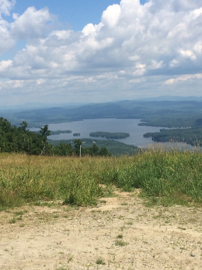
View of Lake Sunapee from the last little section of trail, up a ski trail on Mt. Sunapee.
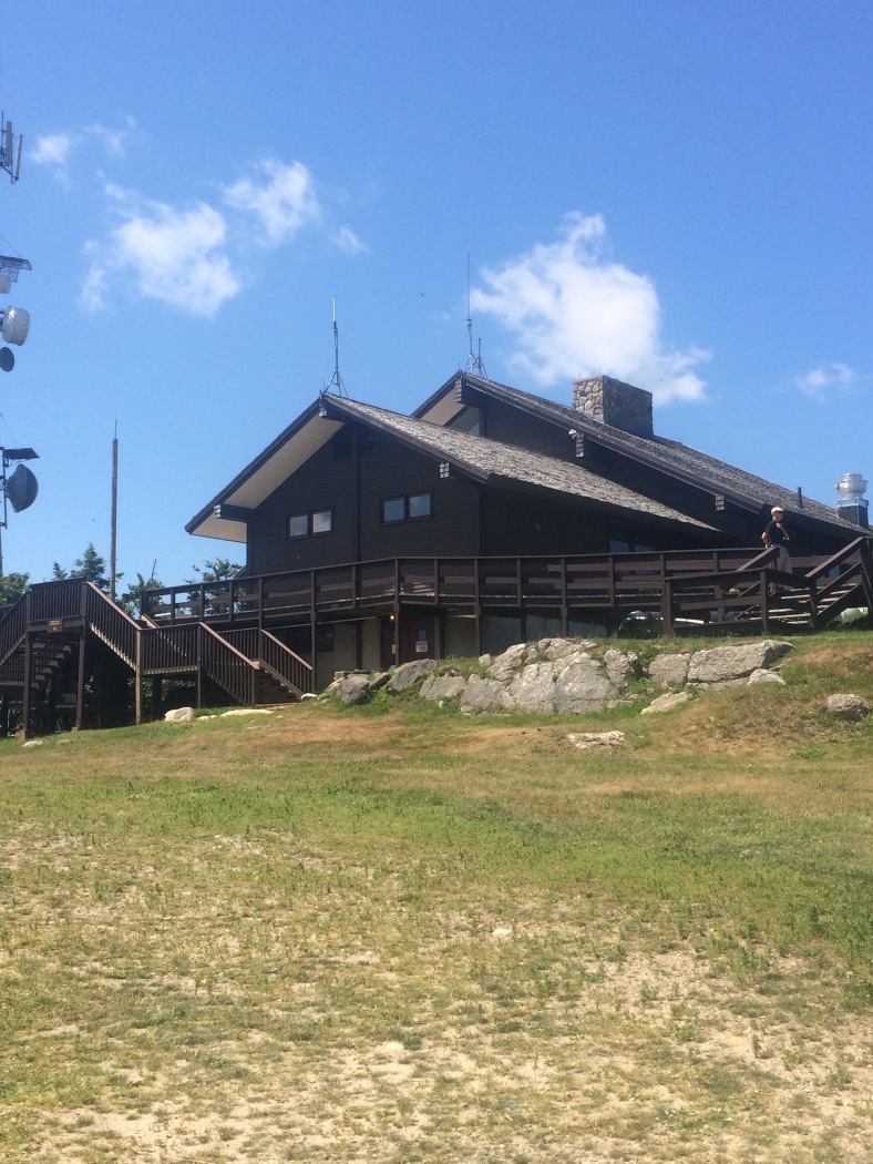
The lodge and the top of Mt. Sunapee, the other terminus of the Greenway.
I am thankful to be blessed with the physical ability to hike, safety on the trail and reasonable (even if a little warm) weather. While the Monadnock Sunapee Greenway might not have the elevation or difficulty of the White Mountains, it certainly is a nice trail and a change of pace from some of the hiking I’ve done in New Hampshire. If you are seeking solitude, then spend a day or three or four out on the Greenway.
