Sunday was the big day. My hiking partner for the day, John in NH, and I had talked this winter about a Presidential Traverse some time during the summer. After some emails, checking the calendar, multiple weather checks, family discussions, setting up a car spot, delaying for a day due weather, the day had finally arrived.
With the cars in their respective positions – one at the Highland Center where one of us stayed overnight and the other car at the starting point at Appalachia – we were on our way up Valley Way. We had chosen to traverse north to south to get the elevation gain out of the way early while we were still fresh. The trip of Valley Way was not unusual, we moved along at a good pace and used the time to catch each other up on our families and latest hiking adventures. We took a break at the Watson Path junction and while we were making good time, we did note how sweaty we had become already. We arrived at the hut, a little over two hours into the hike and feeling pretty good, so we opted to leave our packs at the hut, and head up to the summit of Madison. By this point, we were just above treeline and it was very windy, with sustained winds in the 30 mph range. We were fully aware of this and took the time at the hut to change and add layers appropriate for the wind. We made it up Madison and back down, happy that we had covered about half of our elevation gain for the day.
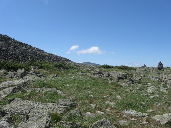
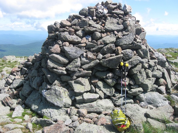
Back at the hut, we took another break to eat and rehydrate. That’s when I started not to feel so well. Not violently ill, but a little nauseated and a little off. I didn’t think too much of it, but fueled up with Gatorade, water and some trail mix. After that, it was off to go over Adams. I started to fall behind on the pace, and was more tired than I should have been, so I slowed down a bit and continued up Adams. Partway way up, I had to take a break and get a bit more fuel and water, as I still wasn’t feeling like I should. I knew something was wrong, but I couldn’t quite put a finger on what it was. As long as I was moving, I felt fine. As soon as I stopped moving, I felt nauseated and bit dizzy. All the while, the wind was relentless and getting stronger as we crested Adams. We decided to just go over the top and down to Thunderstorm Junction, rather than stopping at the summit. I tapped the pin on the way by and headed down the summit cone. We reached Thunderstorm Junction and although a bit slow, still on track for the traverse.
I still wasn’t feeling right and having been on this route before and knowing what was ahead of us – the longer stretch to Washington with Jefferson in between – we had to make a decision as to what to do. I was starting feeling better, but heading to an area where it is difficult to get help if something should really go wrong, wasn’t smart. Heading out into the wind, which can really take a lot of energy and concentration, especially for another couple of hours wasn’t smart, either. After being honest with myself, and thinking it through logically, “Think like a man!”, in the words of my partner, I had to admit the best thing to do was to not continue on the traverse. My partner got out his map, and start to look for a route down that would loop us back to the car at Appalachia. I was starting to feel physically better, and mentally I think I was relieved that the decision was over and the pressure of the traverse was off. My partner is working on red-lining, so we decided to take a new trail down that neither of us had been on, which would afford us some nice views in King Ravine, a chance to check out Crag Camp and some other little spur trails along the way.
After a lot of analyzing, I think what happened to me was that I had become too dehydrated on the way up Valley Way. I just didn’t drink enough and didn’t replace all the electrolytes that I lost by sweating. I usually carry 2-3L of water whenever I hike, as I need a lot of water. Thinking I could save a bit of weight on a section with a lot of elevation gain, I carried 1.5L up Valley Way. That might be fine for some people, as water is available at the hut when the hut is open, but that just wasn’t enough for me personally. Unconsciously, I think I tried to conserve water knowing I didn’t have much and ended up not drinking as much as I should have. Add to that the wind factor above treeline, which takes a lot of energy and concentration during hiking, not to mention the dehydrating effects and things weren’t good for me. While I did drink a lot of water and had Gatorade at the hut, my body really didn’t process that until we got to Thunderstorm junction, after making the climb over Adams.
After a bit more break, I was feeling much, much better and we took off down the Spur Trail to see what it had to offer. Due to the brilliant sunshine and relatively clear day, we had some great views into King Ravine and since my partner had hiked some of the trails on the other side, he was able to point out certain trails and really how steep and tough they were. We continued to descend until we came to the spur trail for Knight’s Castle, a rock outcrop with another view into King Ravine. Now that we were into red-lining and sight-seeing mode, we went down the spur trail to see the sights. What a great view across to the other lip of the ravine and it jagged, cliff and boulder strewn edges and floor!

A few bunchberries and mountain cranberries were still in bloom. I’m always amazed at the tiny alpine flowers and their tenacity in such a harsh environment.
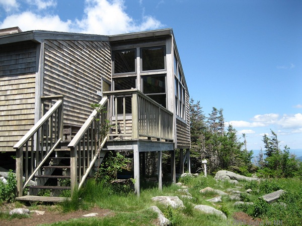
Continuing to descend, we came to Crag Camp to check out the facilities there. The views from this camp, perched on the edge of the ravine were amazing. Moving along, we headed further down the trail, taking the side path to Chandler Falls, a pretty cascade and pool. We finished up the Spur Trail, took a right onto Randolph Path for a short bit and ended at the Pentadoi, an intersection of five trails. With a check of the map, we started down the Amphibrach Trail. As a side note, the RMC has built an amazing variety of trails on Adams and Madison for every hiking style and ability, but due to the abundance of trails a quick check of the map is a good idea at the larger intersections to stay on the correct trail.
By this point, the footing was better, the trail not so steep and we moved along quickly and eventually were almost at the end. We stopped at Cold Brook Fall, enjoying the view of the falls and pool below. We then came to the Memorial Bridge, a pretty bridge built in the 1920’s, according to the plaque. We then came to yet another intersection and had to make another decision – did we head to the parking area via Amphibrach or Sylvan Way? Distance and terrain wise, it didn’t matter, as it was easy walking at this point. Red-lining logic won out, as taking Amphibrach would completely finish off that trail, so that my partner would have not to hike that last little section in the future. We were parallel to Rt. 2 at this point and could hear the traffic, so Sylvan Way would probably be a good choice for a quieter future hike. Very quickly we were back at the car and ready to head off to pick up the other vehicle.
I am disappointed that I wasn’t able to finish the Presi Traverse, and I will certainly be out there again soon with another attempt. I’ve learned some things from this adventure and have already planned for a much better result next time.
Despite the disappointment, we did have a beautiful day in the mountains and did not waste the opportunity to be on the summits, explore new trails and enjoy the sights along the way. A special thanks goes out to my partner, John in NH, for not only letting me use a few of his photos for this post, but more importantly for being gracious, understanding, level-headed and honest with me when I needed it most on the trail!


Summerset, this episode brings to mind a saying, which goes something like this.
“Disappointments usually occur when we attempt to do something great. If you want to avoid being disappointed, don’t attempt anything great.”
From what I know of you, a successful Presi Traverse is definitely in your future! And, even with the circuit that you ended up completing, that was still quite a significant hike, plus it enabled you to travel trails that were new to you
.
Your report was great, and you got some excellent photos. Sounds like a winning combination to me!
John
Thank you so much, John. You don’t know how much your kind words are an encouragement to me!
I’m glad no one was hurt and that good judgement prevailed. I’ve yet to try the traverse… maybe late August. Your posts are extremely insightful and very well written. Thanks for another great report.
Thanks Rich! We did the best we could to make a smart and reasonable decision given the all the factors. This is also points to being wise in your choice of partners for hikes that have a higher risk factor.
Summerset,
Nice write up of the day. It sure was windy. Even though we didn’t make it to Pierce it was still a great day– the loop we ended up doing was still one of the best day hikes you could think of in the Whites and still had 5000′ vertical gain. You can never take completing the one day Presi Traverse as a given–the mountains are fickle and the challanges of such a demanding hike mean you always have to pay attention to yourself and surroundings as you proceed or not. You definitely have the one day traverse in you, I know it!
Thank you so much, John! We *did* have a great day, and I did keep my promise of no major bleeding. LOL. Just dehydration and nausea instead! Thanks for the confidence, you know I’ll try it again some time.
Hi Summerset,
Sorry I haven’t been commenting on your posts sooner – I just realized that I can subscribe to non-Blogger blogs, which I had previously assumed was not possible.
Glad to hear you made it down alright, and had a memorable hike despite deviating from plan. Hiking is a learning experience and there are no true experts (thankfully, because if we ever became experts where would the fun be?)
On a winter ascent of Adams and Madison, I didn’t realize I had forgotten my water back in the car until reaching tree-line on Airline. You can bet I’ll never make that mistake again. (Oddly I didn’t forget to put the celebratory beer in my pack…)
I’ve also come to realize that I need to eat and drink more before and during ascents, because I often experience that sick feeling you described.
Anyway, I’m getting off topic. Great report, pictures, and adventure. Keep it up!
Owen
Thanks, Owen! You’re right, hiking is a learning experience, and if we are humble enough to admit it that and can take away a lesson for the next hike, that’s great.
Just remember that if you had planned to just summit Madison and Adams it would have been an impressive hike, and no one would have thought twice about it.
BTW, in the second paragraph you twice wrote “Monroe” where you meant “Madison”.
Cumulus – thanks, you’re totally right on both accounts. I got the wrong name on Maddy, twice! I fixed it.
You are an incredible young lady with the wisdom of an old timer. Congratulations on completing the traverse. Congrats to Cameron & Dakota as well. Will catch up with you… Schorman